|
|
|
|
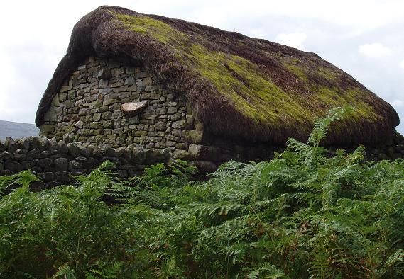
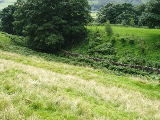
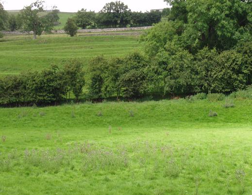
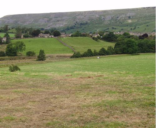
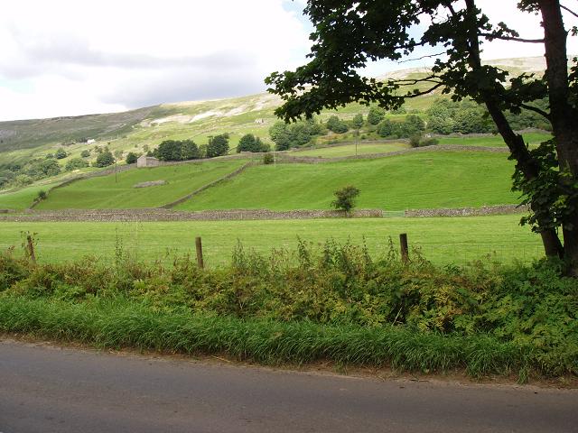
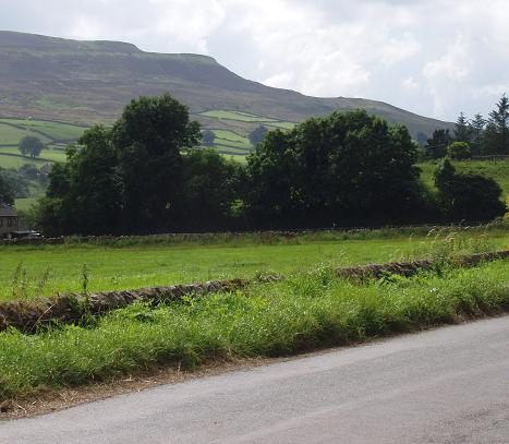
4th. August 2012: Glacial geomorphology and anthropogenic alteration in Swaledale: moraines mines and mounds. Leader: Dr. Jon Barber, Univ. of Leeds. A party of nine members and our leader, Dr. Jon Barber of Leeds University, set off from Reeth Village Green on a round trip of about 6 miles via Skelgate Lane, along the southern edge of Reeth Low Moor to Thirns, then in a south easterly direction via Healaugh down to the northern bank of the River Swale at about SE020987. From there a traverse was made alongside the river, crossing to the southern bank at the Swing Bridge, erected in 2002 to replace the original built in 1920, but destroyed by floods in the year 2000. The party then travelled in an easterly direction to Grinton, and from there, back to Reeth. After reaching a height of about 1150ft. the party rested while our leader gave an overview of the factors which have left evidence of profound variations in climate, especially in the last 2.6 million years, such as orbital forcing, i.e. variations in the following: distance of the Earth to the Sun (eccentricity), 100,000yr. cycle, tilt of the Earth's axis (obliquity), 41,000yr. cycle, and axial precession (the Earth's "wobble"), 19 to 24,000yr. cycle. Mention was also made of the so called Heinrich Events. During these events large icebergs break off from northern hemisphere ice shelves. It is thought that this periodic release of huge volumes of fresh water into the north Atlantic Ocean would affect ocean circulation, such as the Gulf Stream. Convergence of these cycles could lead to extreme changes in climate. During the traverse, it was pointed out that it was occasionally difficult to distinguish natural features from mining activity, especially for lead which is believed to have been carried out since Roman times. A lead ingot or "pig" is said to have been found at Hurst in Swaledale marked HADRIAN, but has since been lost. Ice caps centred on Mallerstang, Baugh Fell and Great Shunner Fell resulted in glaciers invading Swaledale and Wensleydale. There is evidence to indicate that the ice overtopped the divide between the two dales. During the traverse examples of material deposited by a glacier were seen. Ridges along the sides of the valley were interpreted as a lateral moraine, i.e. frost shattered material from the valley walls falls onto the ice surface, is carried along the sides of the glacier forming ridges when the ice melts. Mounds were noticed which were interpreted as kames, i.e. mounds of sediment which accumulated in a depression or chasm in a retreating glacier. North of Healaugh, at about SE014993, a deep gully was observed and interpreted to be an ice marginal channel, i.e. a channel cut by flowing water along the ice margin, (cf. photo's). (Nearby, an example of efforts to regenerate Swaledale for tourism is the renovated "thatched" cottage which received an award in 2010). Along the northern margin of the river what were thought to be river terraces turned out to be lynchets which are features of ancient field systems. As the party progressed along parts of the gravel river bed, a search was made for far travelled erratics, e.g. the famous Shap Granite. However, all the rocks examined were locally derived, i.e. further proof that ice did not originate from the Lake District or Silurian rocks of the Howgill Fells. Further on, at about SE035986, the northern part of the Grinton end moraine was observed on which the village of Reeth stands. East of Grinton, the southern end of the moraine is marked by a gorge through which the River Swale eventually forced its way. The Grinton moraine is one of four End or Recessional Moraines which formed when the climate alternated between warm and cold phases. During a warm phase, as the glacier retreated meltwater would form between the ice margin and the end moraine resulting in a lake flat. During a cold phase, the glacier would stabilise and build up another end moraine. In Raistrick's paper "Periodicity in the Glacial Retreat in West Yorkshire", (1927), he recognised four such retreats and standstills, from Ellerton to the east, followed by Grinton, Feetham and Gunnerside. Unfortunately, he was unable to calculate the intervals between each cycle. Radio carbon dating had not been discovered in 1927. Perhaps evidence from laminations (varves) in the lake deposits might also prove illuminating. After a hearty vote of thanks was given to our leader, Dr. Jon Barber, the party dispersed. Further contributions to this field excursion will be most welcome. All errors/ omissions are to be credited entirely to the author, John Waring, Field Trip Organiser, N.E.G.S. Aug. 6th, 2012 |
|
|
|
|
Renovated cottage roof c.1/4 mile NW of Healaugh. |
Ice marginal channel about SE 014993, north of Healaugh. |
|
|
|
|
Lynchets on N. bank of the R. Swale: not to be confused with river terraces. |
Part of the Grinton End Moraine on which Reeth stands. |
|
|
|
|
Part of the Grinton End Moraine nearer the village of Grinton. |
Near Reeth, looking westerly at a typical Yoredale sequence (cyclothem). |