|
|
|
|
A party of sixteen people from the Craven & Pendle, Northeastern,
and O.U. Geologocal Societies assembled at the newly furbished Keld
Resource and Heritage Centre in Keld, Swaledale. John Barber, Univ.
of Leeds was the leader. |
|
|
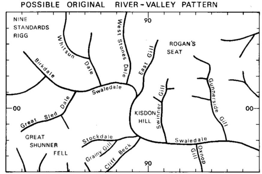
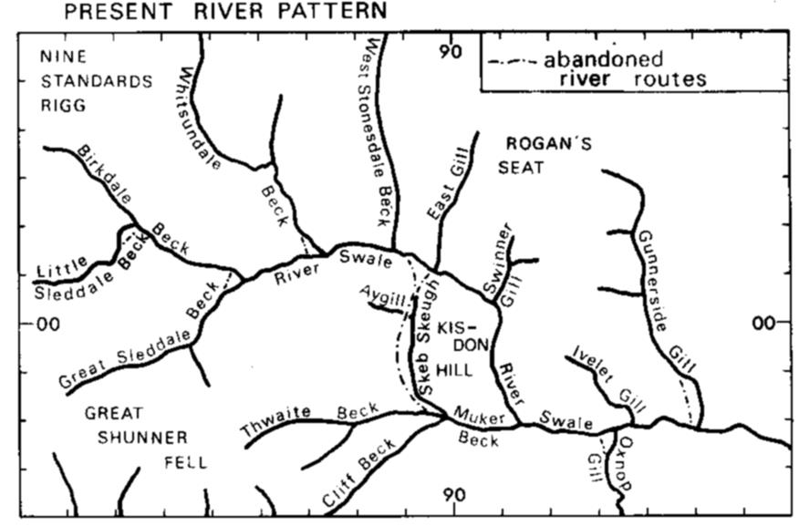
From general valley patterns of the area it appears that the
north-south valleys of East Gill and West Stonedale were originally
tributaries of the pre-Devensian River Swale which then flowed down
Skeb Skeugh then along Muker (Straw) Beck eventually to join its
present course. |
|
|
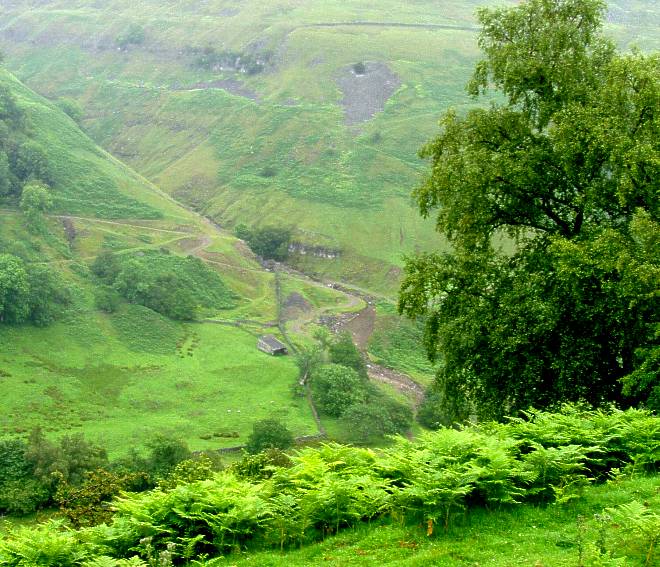
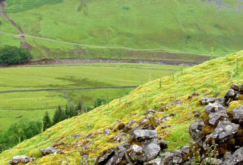
The party did a circular tour around Kisdon starting from Keld through to Birk Hill (NY898007) then continuing along the high path running roughly parallel to the R. Swale then a westward route towards Thwaite ending with a traverse northwards along Skeb Skeugh back to Keld. Below are illustrations of some of the geomorphological features resulting from post-glacial readjustment of the landscape. |
The above diagrams are from: |
|
|
|
|
Piedmont fan at mouth of Swinner Gill subsequently cut through. |
River terrace in R. Swale near Hartlakes. |
|
|
|
|
Meander scrolls on a floodplain near Hartlakes |
Rotational (?) landslip, Hooker Mill Scar |
|
|
|
|
Looking northerly at Skeb Skeugh abandoned valley. Kisdon to the right. |
Looking southerly at Skeb Skeugh abandoned valley. Kisdon to the left. |
|
Further reading: Rose, J. (1980): Landform development around Kisdon, Upper Swaledale, Yorkshire. Proc. Yorks. Geolsoc. Vol. 43, pp. 201-219 |